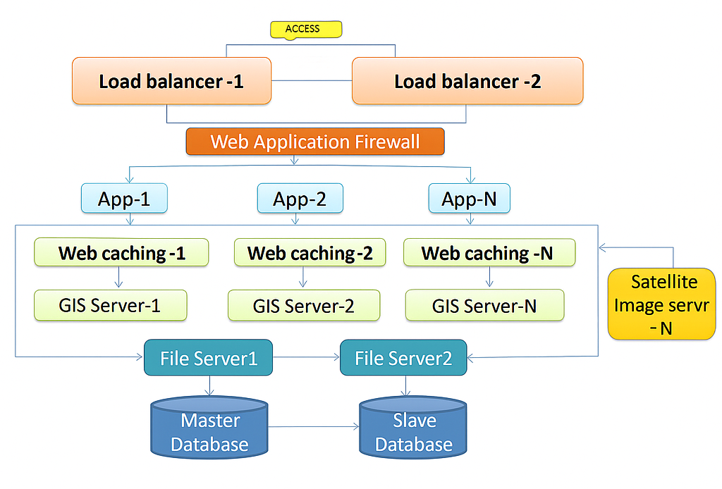
Modalities of implementation
(Technical, Financial, Operational, Legal, and other aspects) of implementation in
other friendly nations)
- Technical
- Establish national mechanism for geotagging assets via satellite/drone mapping.
- Enable API-based integration between country systems and a unified geospatial platform.
- Provide capacity building for data integration and planning.
- Operational
-
Create a nodal agency to coordinate data collection and ministry-level participation.
- Adopt SOPs for layer creation, metadata management, and approval workflows.
- Establish periodic data updation cycles and monitoring mechanisms.
- Legal
- Ensure national geospatial policy permits mapping, sharing, and controlled dissemination of data.
- Define custodianship and access rights for sensitive geospatial datasets.
- Align platform usage with national security and data protection laws.
- Policy
- Government mandate for integrated, multimodal infrastructure planning.
- Framework for inter-ministerial coordination to support platform adoption.
- Policy roadmap for scaling GIS-based planning across sectors.